Sometimes the stars align and entering an event is meant to be! Entries to the Rogaining NSW Hawkesbury ‘Minigaine’ were extended just before the hazard reduction burn I was scheduled to do was postponed, and then a friend asked if my little guy could join hers for a play date. I entered the 3hr Rogaine and I was super-excited for a bonus adventure!
As a trail running personal trainer and an instructor in the NSW Rural Fire Service, I teach navigation skills, and have done plenty of off-trail navigation, search and rescue and emergency services exercises however, I’d never actually participated in a competition Rogaine by myself! Oh the nerves and self-doubt! Really? Yes, really, I’m human!
So, what is Rogaining? ‘Rogaining is the sport of long distance cross-country navigation, in which teams of two to five people visit as many checkpoints as they wish in a set time period. The traditional Rogaine is 24 hours in duration, however, there are also shorter events of 3, 6, 12 and 15 hours’. (http://nswRogaining.org/index.php). It is very similar to Orienteering, although Orienteering NSW events tend to be shorter duration (45-90min) and they often run more events in an urban environment. Both Rogaining and Orienteering can be done in a team or as an individual (depending on the event) and families are encouraged to participate.
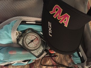
I knew I had the fitness to do a 3hr event as I was reverse-tapering after the 6 Foot Track Ultra Marathon. I anticipated that running off-track whilst navigating, and in pretty hot conditions, I’d probably only get 10-15km at most in 3hrs! I prepped my pack with Tailwind, food and water as I would for my normal 3hr run, then added a compass, the compulsory gear and an extra 500mL of water for the heat. I was ready!

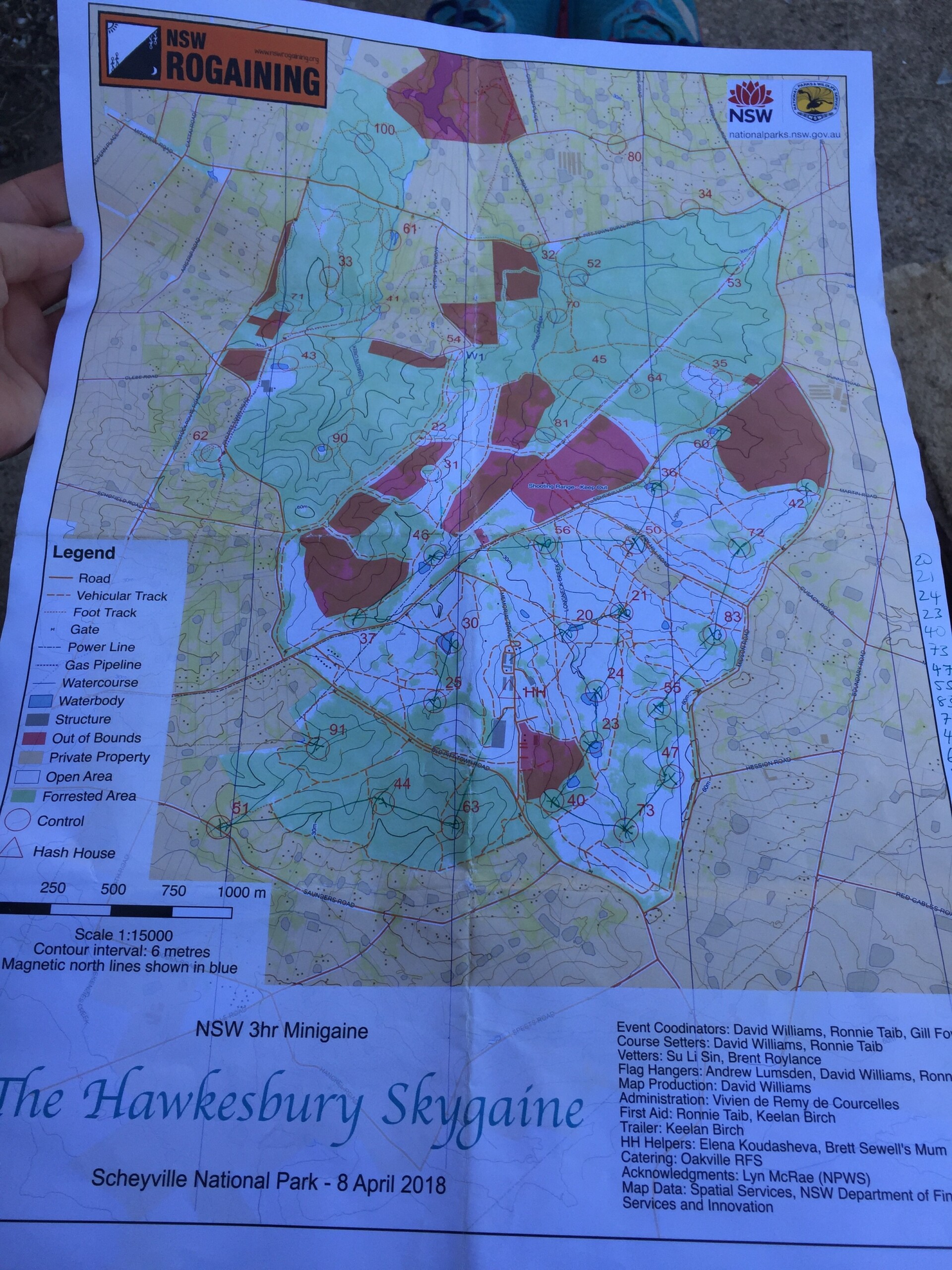
In some events you have to plot 8-figure grid references onto the map before you can then see where all the ‘controls’ are and plan your route. For this event the map came with all the controls already plotted on it. On the reverse is a description of each control. Usually they are very brief like ‘the gully’ or ‘the spur’. It pays to know what these features are! Each control has a number and is worth a corresponding number of points. Controls 20-29 are worth 20 points and tend to be either closer to the ‘Hash House’ or easy to navigate to on easily recognisable features such as large dams or knolls. Those controls with higher numbers are further away and harder to find once you get out there. You have to plan your route to collect as many points as you can, and get back to the Hash House within the timeframe. The team or person with the highest score in the shortest time wins. Everyone gets to set their own challenge and choose their own adventure so I think really everyone wins!
I chose a fairly conservative route for my first few controls to get a feel for the scale of the map and the depth of the gullies. Scheyville National Park is fairly flat and has a lot of grassland (and nasty prickle bushes I found out) so I wasn’t sure how hard it would be to recognise features, how much I’d have to use my compass and how distinct spurs and watercourses would be. Sometimes it’s easier to navigate in huge mountains than on flat grassland because you can see the highs and lows more easily! The first controls were easy to find, there were a few people heading in the same direction and they were near dams, I was having fun already! The course had a lot of tracks to follow, but I wasn’t afraid to navigate off track and go cross-country. I had to go slowly at times due to broken glass in the grass (thanks to my trail shoes for having a strong plastic sole!).
Some events have a little hole punch that you have to punch your team card, but this event had electronic timing chips on a wrist band. When you found a little orange and white kite hanging in a tree, the timing wand was attached and you had to stick it in your chip and wait for a flash. Then, off to find the next control! I’d seen the electronic timing work well doing a kids Orienteering course with my son a few months earlier, I think it was the highlight for him!

I smashed out the first 12 controls fairly fast as they were close and not hard to find. I was having a great time! However, the heat was baking me out in the grasslands! I started to feel a little heat-affected and stopped under a tree for a break. I had a choice, go further north and get some higher-scoring controls, or go south and keep closer to the Hash House in case the heat affected me too badly. I chose to go south, and after one more hill in the sun I was able to spend the last hour in the shade being a little more conservative. Once in the shade I was on trails again and felt recovered enough to jog along. You’re not allowed to use a GPS watch or app, so I’d set an alarm on my phone for 2hrs and 2.5hrs as decision points. At 2hrs I wanted to start moving back towards the Hash House and at 2.5hrs I wanted to be wrapping things up and doing my last couple of controls. There is a penalty of 10 points for every minute you are late! You can undo a lot of good navigation by not judging your return!
Everything went to plan and I found myself with only two easy controls left on the way back to the Hash House. I skulled the last of my water at the 2.5hr mark and that made me keen to get them done and get back up the last hill! I found the map very accurate as far as vegetation was concerned- kudos to the course setters! There were plenty of controls hidden in prickle bush, but if you read the map you could see an access point for each control through grassland. The last two controls I had a go at following animal trails in through the scrub and I still have the thorns in my hands and scratches on my legs to show for it- probably should have stuck with plan A!
I made it back to the Hash House and punched my timing chip at 2.53hrs and was really happy that I had not once got lost or failed to find a control straight away. The map was very accurate and my training obviously up to scratch, I got 1020 points! I cleared the southern part of the course, which I was very happy with. I’m a slow runner and usually manage to go about half the speed of the winner at any trail event and I think I was about on par at this event too. The majority of participants were in teams and friendly groups hiking, some with kids and grandparents. There were of course some really competitive and fast people too, and the beauty of these events is that everyone can choose their own adventure and go as far as they like, they can choose hills or flat, grassland or woodland, and you can stop and picnic any time or finish early.
As with any event we go to these days we have a ready-made set of very best friends to encourage and cheer! It was lovely to meet RMAs Louise, Kim, Vicki, Sam and a couple of other friendly ladies. Thank you for welcoming me! I was also pretty lucky that Oakville RFS were doing the catering because I got to hang with them before and after too. The event was very well run by wonderful volunteers. Would I do it again? You bet! I’ve already scoured the Orienteering calendar for events to take my son, and am hoping to get to another Rogaine again- when the stars align!


